ExplainedWeather
What a 'very severe' cyclone means for the Andhra coast: winds, storm surge and landfall explained
The IMD says Cyclone Akvan could reach very severe strength before it nears north Andhra Pradesh this week. What that grade means, why the sea can be more dangerous than the wind, and what 'landfall' and the colour alerts actually tell you.
The short answer
In the India Meteorological Department's scale, a very severe cyclonic storm has sustained winds of 118 to 166 km/h. The IMD expects the depression now in the Bay of Bengal to reach that grade by early November 19, with winds of 120 to 130 km/h, but it has not named where it will cross the coast. For people on the shore the biggest danger is often the storm surge, a rise of sea water above the normal tide that can flood low land well inland, and the warnings are built around when and where that water arrives.
What does ‘very severe’ mean?
It is the second grade above a plain cyclonic storm on the India Meteorological Department’s scale, with sustained winds of 118 to 166 km/h.
The IMD grades storms by the strongest steady wind near the centre. A cyclonic storm starts at 62 km/h, a severe cyclonic storm at 89 km/h and a very severe cyclonic storm at 118 km/h. Above that come the extremely severe grade (167 km/h) and the super cyclonic storm (222 km/h). Our guide to the grades has the whole ladder.
The depression now over the southeast Bay is expected to become a cyclonic storm on Monday, when it is named Akvan. The IMD’s Sunday bulletin then has it at 90 to 100 km/h by Tuesday evening and a very severe storm by early November 19, with winds of 120 to 130 km/h and gusts of up to 145 km/h. Those figures are for the sea. A storm usually loses some strength as it nears land.
The IMD's forecast for Akvan
- November 16Cyclonic storm; named Akvan
- November 17Severe cyclonic storm, winds 90 to 100 km/h
- Early November 19Very severe cyclonic storm, winds 120 to 130 km/h, gusts to 145 km/h
What does ‘landfall’ mean, and why is it not named yet?
Landfall is the moment the centre of the storm crosses the coast. It is not when the first rain or wind arrives, which can be a day earlier and a hundred kilometres away.
Forecasters cannot yet say where that will happen. On Monday the system was about 960 km from Visakhapatnam and moving north-north-westwards at about 15 km/h. Reports of the latest forecast point to the north Andhra coast and a crossing around November 20, with winds of 110 to 120 km/h expected at that point. The IMD has said the track will firm up once the storm forms. Until then a landfall point, even a district, would be a guess, and a guess can send people the wrong way.
Why can the sea be deadlier than the wind?
Because of the storm surge. It is the rise of sea water above the normal tide, pushed towards the shore by the storm’s winds. It is not rain and it is not a river in flood.
Surge is measured above the astronomical tide, the level the tide tables predict for that hour. A past IMD warning for low-lying Andhra Pradesh and Yanam spoke of about 1 metre above that tide, with flooding of low land likely, and tied the risk to the time of landfall. The danger depends on the storm’s size, its strength and the shape of the coast: a shallow shelf or a funnel-shaped bay raises the water further. No surge height has been forecast for Akvan yet.
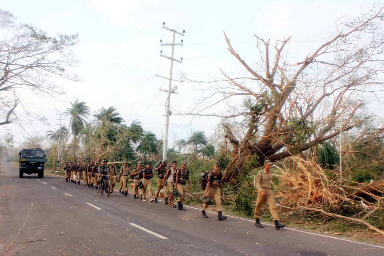
The surge can reach shore before the eye does, which is why warnings are issued early. Abroad, Typhoon Haiyan’s surge of about 7.5 metres killed or left missing about 7,350 people in the Philippines in 2013. In India, the 1999 super cyclone in Odisha killed about 10,000 people.
What do the warnings mean?
The colours are an instruction, not a mood. Green means no action, yellow means be aware, orange means be prepared and red means take action. Orange alerts for heavy to extremely heavy rain are already out for Andhra on November 19 and 20, and for Odisha’s coastal and then inland districts to November 22.
At sea, the warnings are stricter. Fishing boats have been told to be ashore, and sea conditions are forecast to turn very high to phenomenal over the central Bay from November 19. Andhra’s ports, except Kalingapatnam, have raised Local Cautionary Signal No. 1, the lowest rung of the port warnings. State disaster officials say further warnings will come as the forecast clarifies.
What happened with the last two storms?
The coast has been tested twice in three weeks. Cyclone Arnab crossed the coast in the Godavari delta on October 28 as a very severe storm, and Cyclone Murasu crossed near Ongole on November 3 as a severe one, with winds of 100 to 110 km/h. The Centre’s response to Arnab shows the machinery that gets switched on: the National Disaster Response Force, raised in 2006, and the state forces carried out rescue and relief, and central teams were sent to assess the damage. Andhra’s first damage estimate for Murasu was about ₹1,919 crore, since revised to ₹2,484 crore.
What should you watch for next?
Three markers: the formation and naming of Akvan on Monday, the severe stage on Tuesday evening and the IMD’s first named coast. After that, the useful things to follow are the district-level orange or red alerts and any surge figure the IMD gives, which will tell residents of low coastal villages whether to move.
Until then the sensible reading of “very severe” is practical. At 120 km/h trees, power lines and kutcha houses are at risk, boats cannot safely go out, and the sea can reach land that is usually dry. Official advisories, not forwarded messages, are the guide to when to leave.
The documents
- Storm Surge Warning (earlier Andhra Pradesh and Yanam warning)India Meteorological Department, October 27, 2025